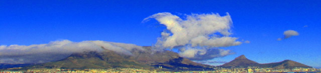
The park is situated at the south-western end of Africa. It
stretches from Cape Point in the south to signal hill in the north (a
distance of about 60km), and dominates Cape Town city's skyline.
It also encompasses a marine protected area running from Moullie
Point in the north to Muizenberg in the east (about 1000km²)
Table Mountain National Park also has a Marine Protected Area that encompasses
almost 1000 km2 of coastal belt and ocean extending from Muizenberg in the east
to Moullie Point in the north.
At the top of Table Mountain one can see breathtaking panoramic views of the Cape. The mountain is composed of sandstone. Its highest point is Maclear's Beacon,which is 1086m above sea level. The flat summit stretches 3km from end to end.
The cable-way provides quick (about 6 minutes travel) safe travel to the summit. Alternatively, there are about 350 different hiking trails to the summit. There is a restaurant at the top, as well as some outstanding viewing points (not for those who suffer from vertigo!).
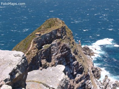
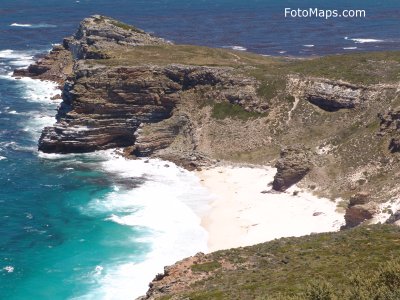
Cape Point is the southwestern most point of Africa (not the southern tip of Africa, this is at Cape Aghulhas). Cape Point lies in the section of the park called "Cape of Good Hope", so named by John II of Portugal (Bartholomeu Dias had originally named it the "Cape of Storms"). With average wind speeds of 35km/h, Cape Point is the most wind-exposed place in all of Africa.
African Penguin colony at Boulders Beach
view from the top of Table Mountain
view from the top of Lion's Head
Chapman's Peak drive
Cape Point